


The Highland Archive Service looks after thousands of documents which tell stories of life across the Highlands in the past. On this page you can watch videos about certain Highland communities, look at some examples of documents, and find some related activities!
Learn with Lorna videos about some of the places in the Highland Archive Service collections:
Examples of documents in the Highland Archive Service collections:
Maps
You can learn a lot about your local area by looking at different maps. The examples below all show different information. Some show houses and streets, and others cover a very large area.
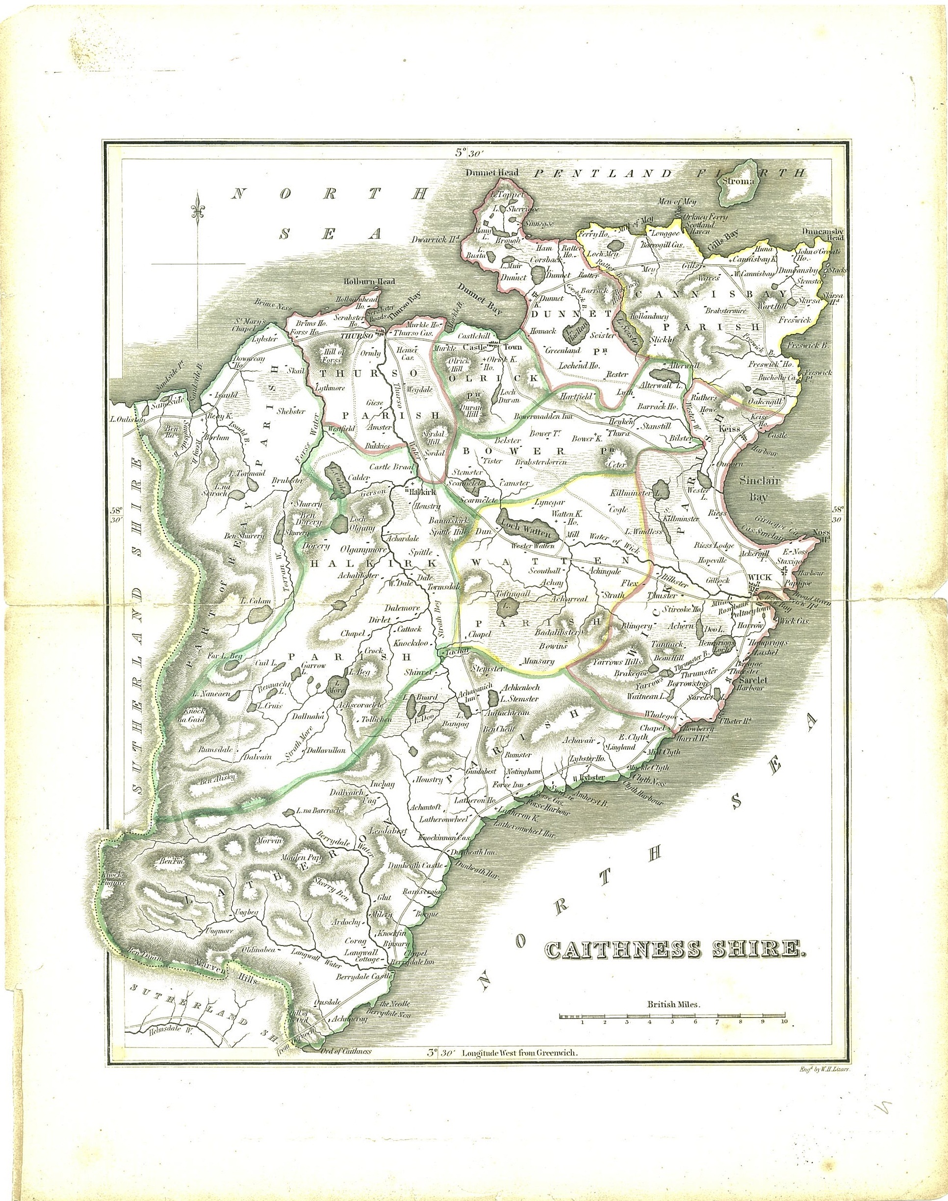
Blackwood map of Caithness, 1838
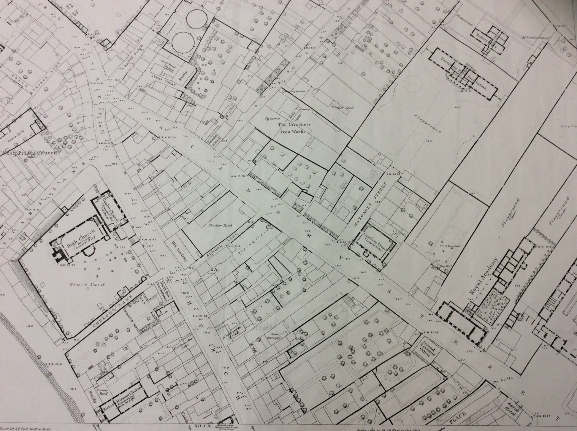
1st Edition Ordnance Survey map of Inverness, 1869
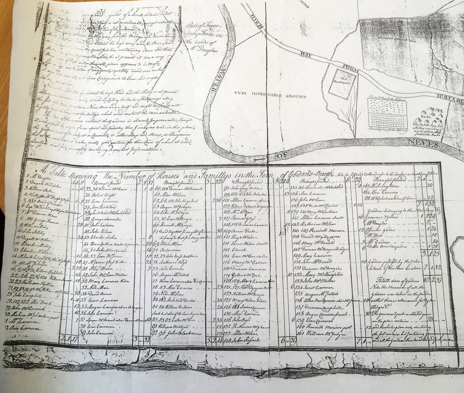
Map of Gordonsburgh (Fort William), 1753
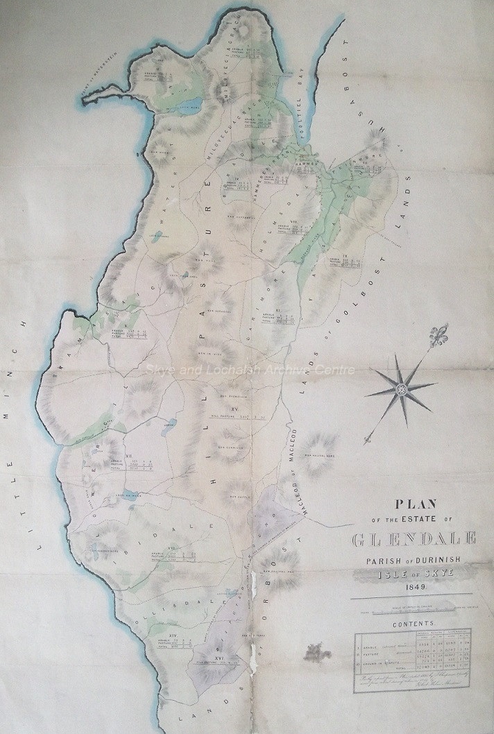
Plan of Glendale estate, Isle of Skye, 1849
Industry
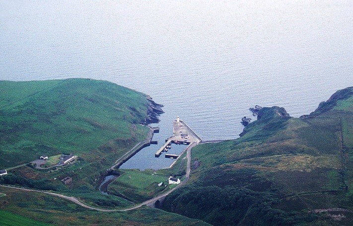
It’s not just maps that can tell us how our local area has changed. Some areas once had booming industries that have now almost disappeared. The pictures below show Lybster Harbour. In the 1830s Lybster was home to the third largest fishing station in Scotland, and in the 1840s there were 263 boats fishing from the harbour! Nearly 200 years later, the harbour still exists but is much quieter than it once was, although the stone pier and jetty you can see there today were built in 1830s.
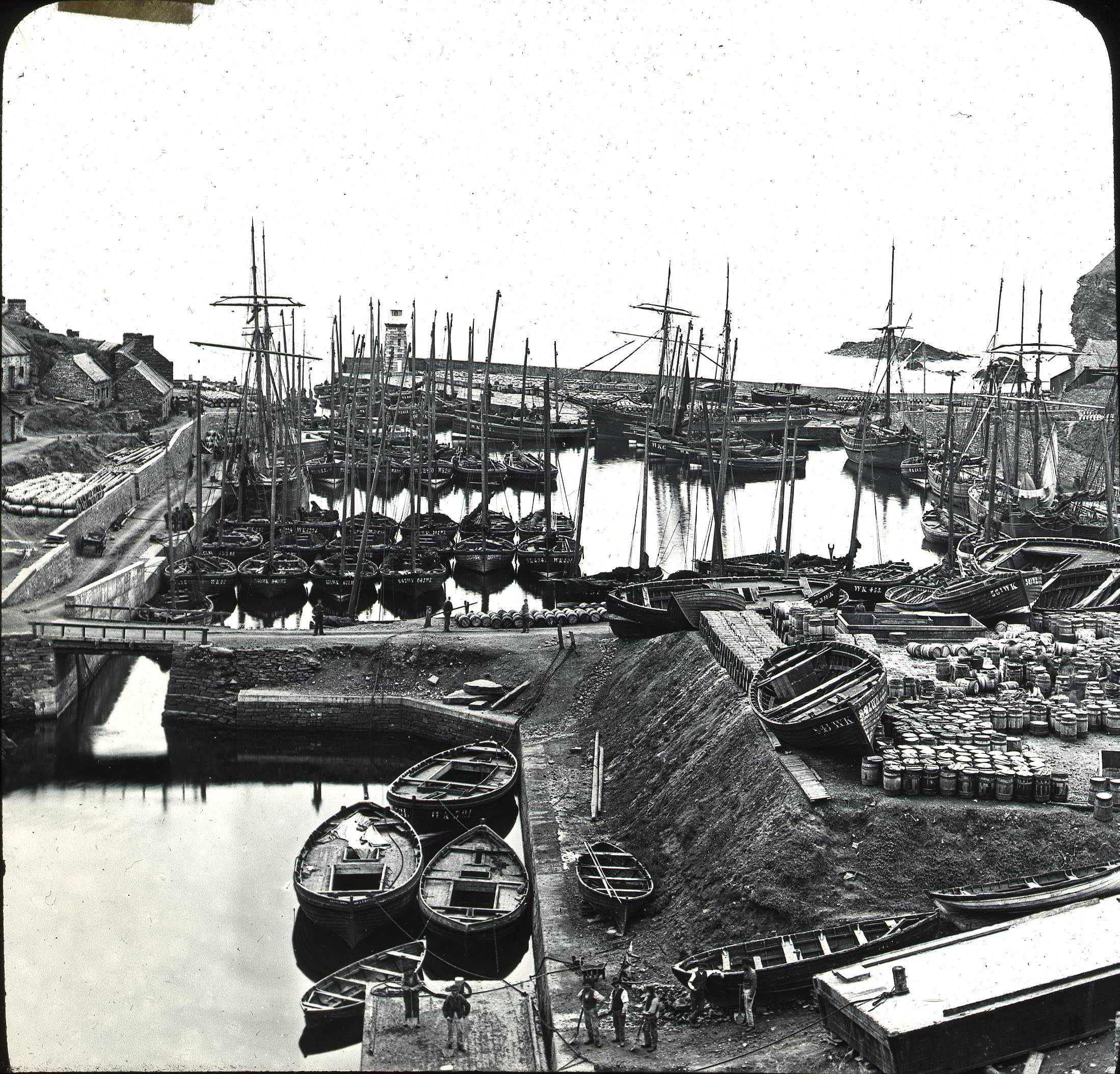
Lybster Harbour, 1903
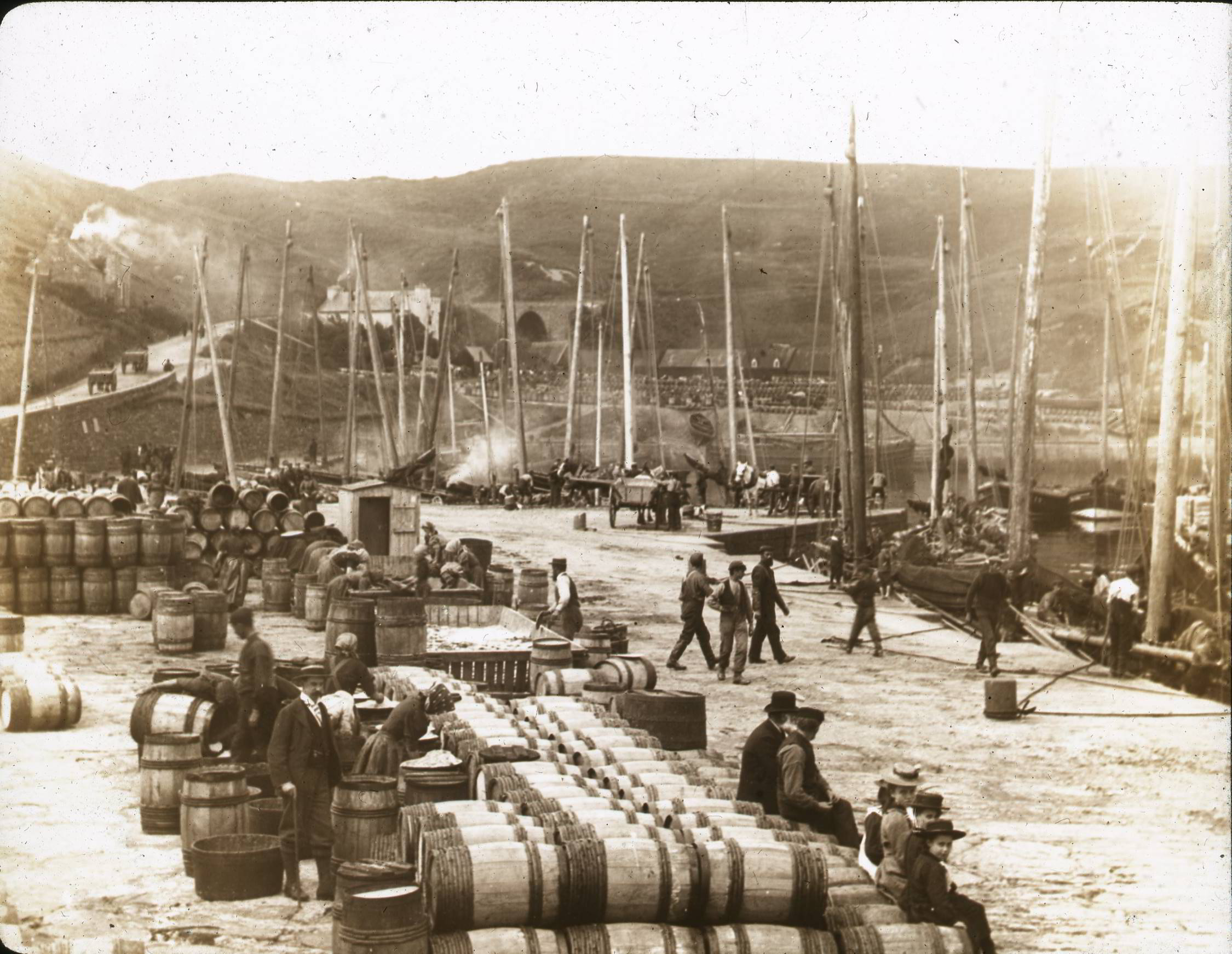
Lybster Harbour, late 19thC
Lybster Harbour, 1990s
Landmarks
Prominent buildings or features in the landscape often have stories attached to them. Ben Nevis, near Fort William is famous for being the tallest mountain in the UK. But did you know that from 1883 to 1904 it had an observatory on the summit, which in 1894 had a small hotel attached to it. Below you can see a visitors' book which shows the names of some of the people who came from all over the world to climb Ben Nevis and visit the observatory. This is accompanied by a photograph of Inverness Castle and the old road bridge (which no longer exists), and a photograph of Fyrish monument. Fyrish Monument was built in 1792 on Fyrish Hill (Cnoc Fyrish), in the parish of Alness. It replicates the Gate of Negapatam in India that General Munro captured for the British In 1781 and is a prominent local landmark.

Ben Nevis Observatory visitor book, 1885
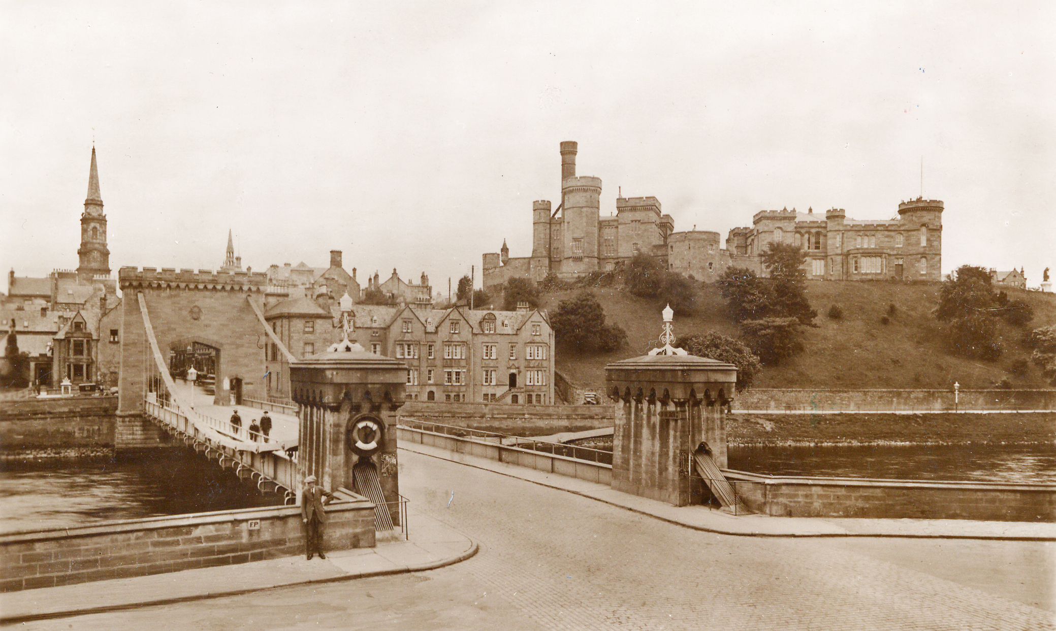
Inverness Castle and road bridge, early 20th C
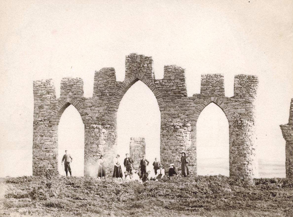
Fyrish monument, c1900
Buildings
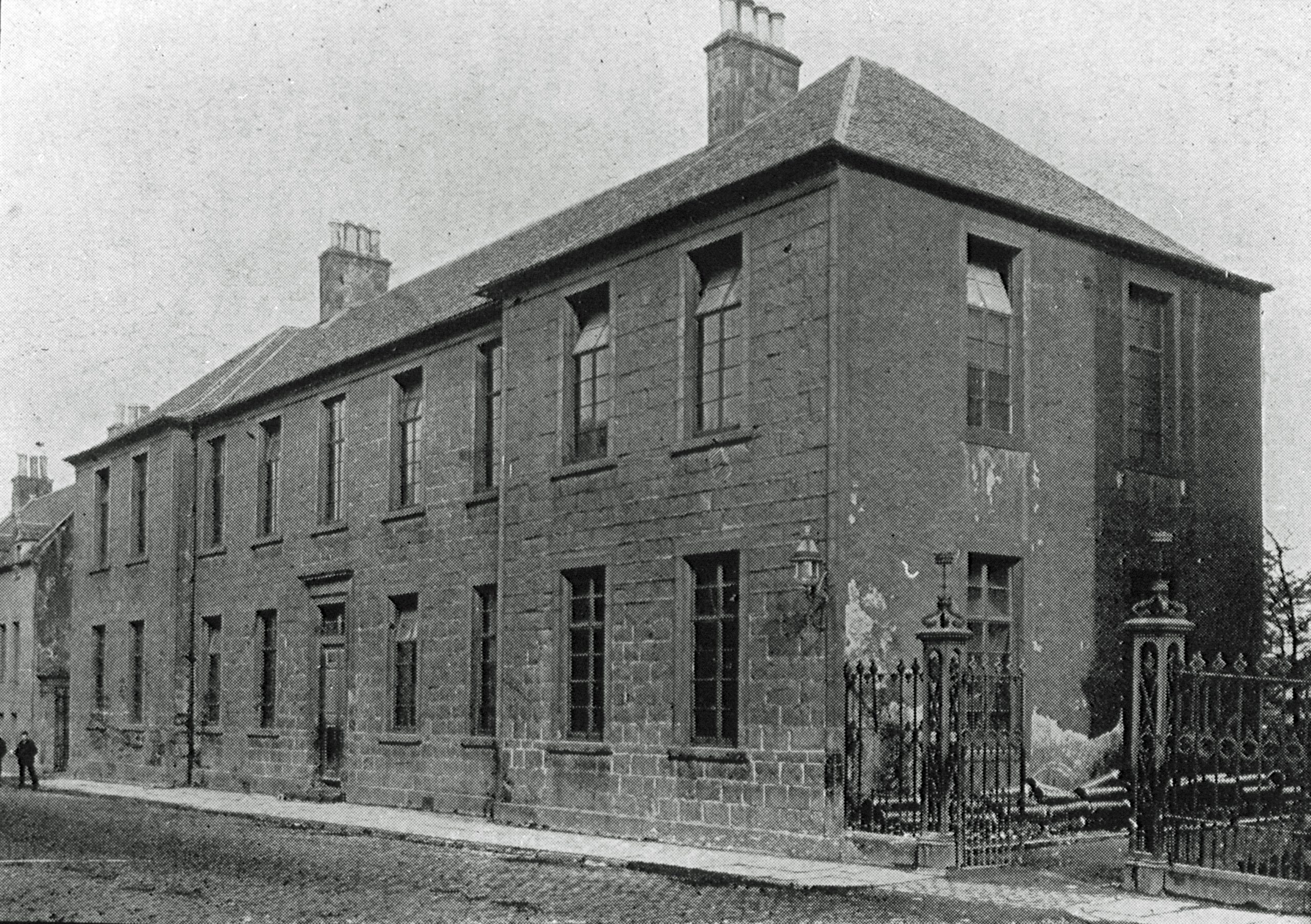
Buildings can tell you lots of interesting things about an area. For example, the buildings pictured below are of Tain Royal Academy and Inverness Royal Academy (in its original location on Academy Street). If you look at the early records of these schools, you can see lots of the funding for building them came from wealthy Highlanders living in the Caribbean. Many of these Highlanders made their money from enslaved people and plantations in places like Jamaica, Grenada and St. Kitts. Also pictured is part of a list of enslaved people on one plantation in Jamaica showing every individual's name, age, occupation and 'value'.
Inverness Royal Academy, 1870s
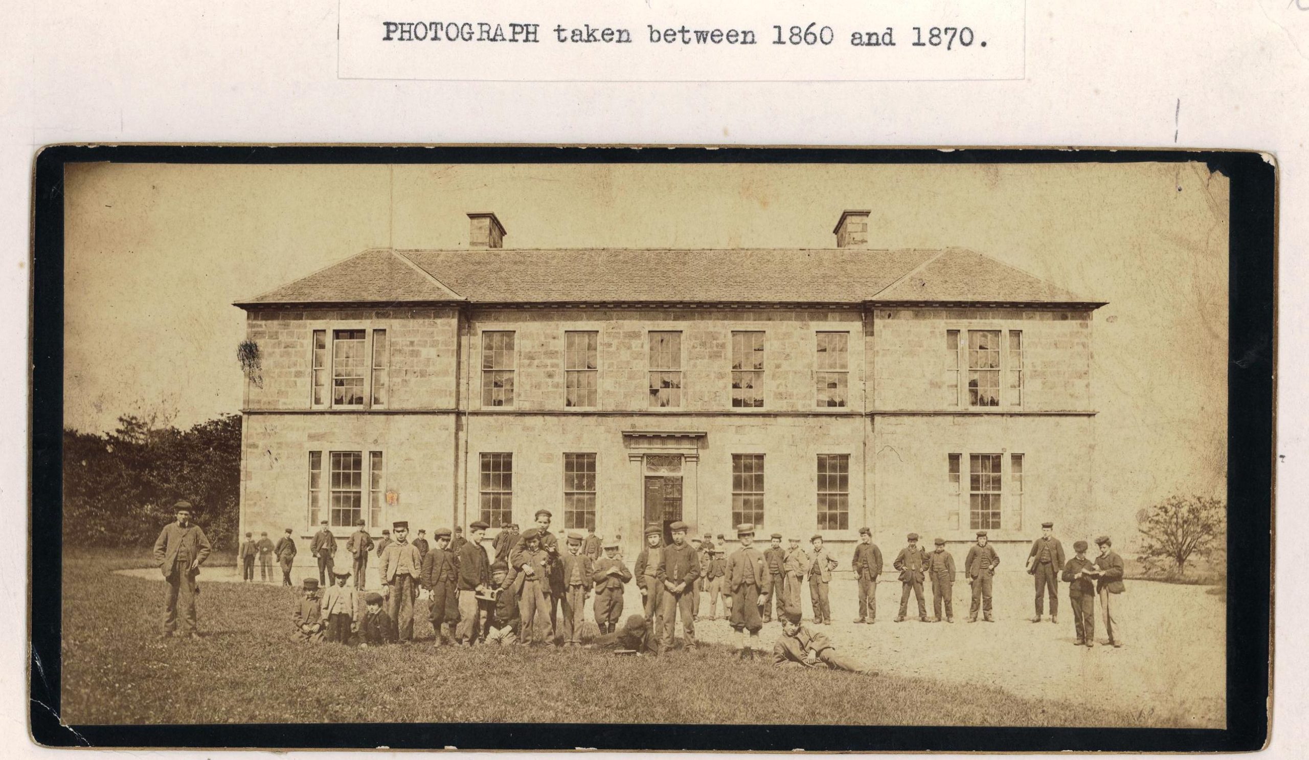
Tain Royal Academy, 1860-70
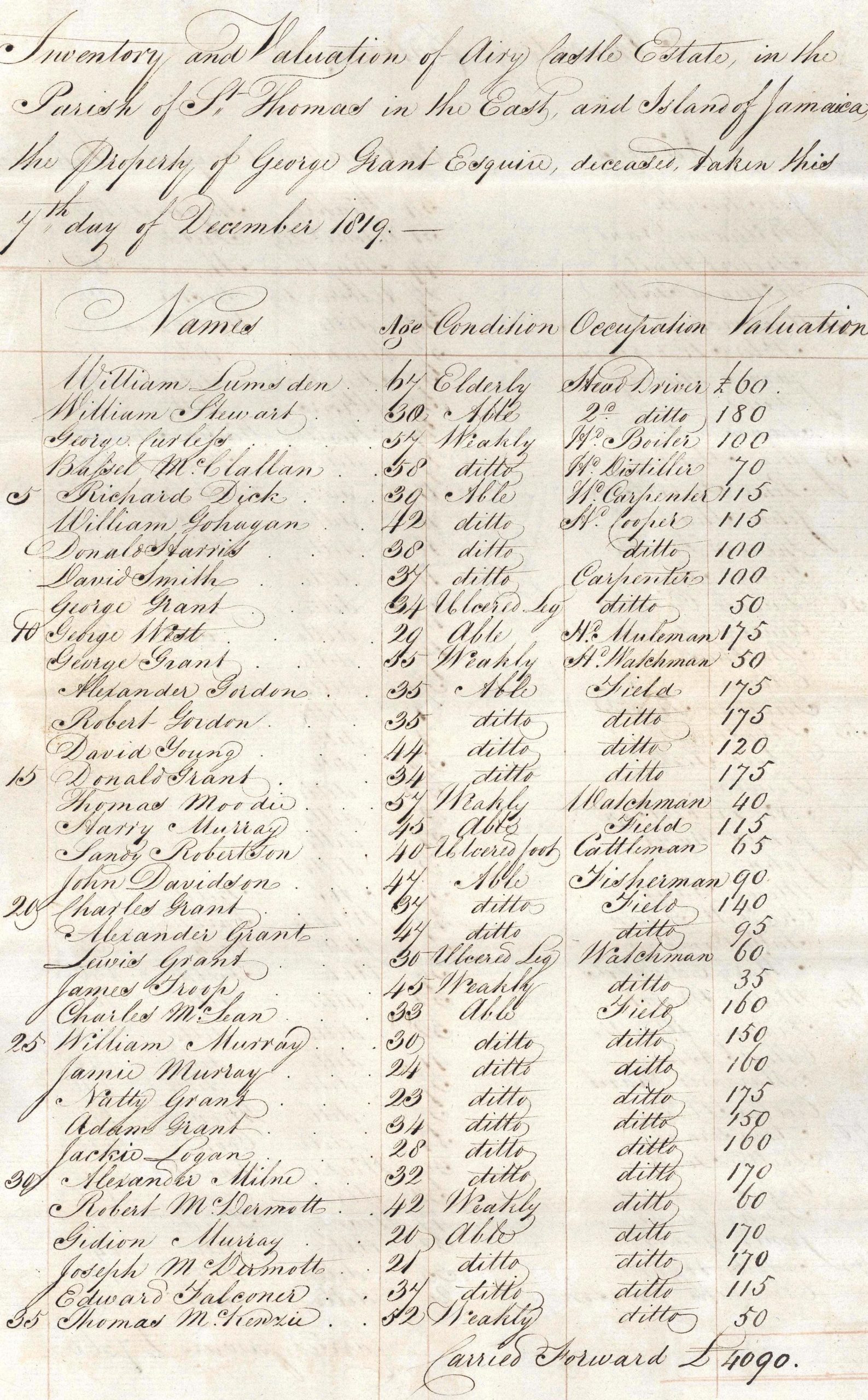
Inventory of Airy Castle estate, Jamaica, 1819
Local area activities
- Create a map of your local town or area. Try to put on as much detail as you can about houses, businesses, parks, landscape features etc. It’s quite tricky to draw something from above when you can’t see it so see if you can use an online map to get started!
- Write a letter to an older person in the community to ask them what they know about the history of the local area.
- Imagine you’ve been asked to plan a new town – draw a plan of it and create a town crest and motto (have a look online for some examples of these).
- Draw, paint or make a model of a local landmark.