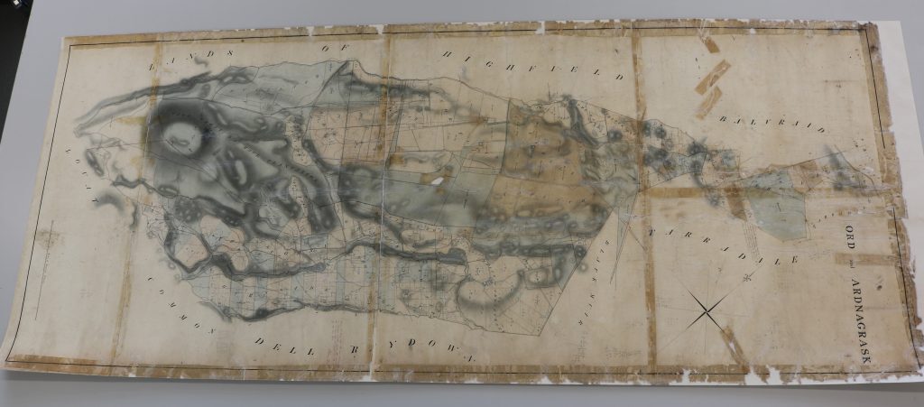


In September 2023 North Scotland Archaeological Society (NOSAS) asked High Life Highland (HLH) Conservation Service to assess the condition of an old estate map for Ord & Ardnagrask. Their hope was to conserve the map and digitise it so it could be shared with people via the National Library Scotland’s online maps website, before gifting it to the Highland Archive Service.
The map, which dates to 1829, covers part of the Ord Estate near Muir of Ord and was recently returned to the Highlands after being found in Somerset. It was in the possession of Dora Fraser-Mackenzie who inherited the Estate on her husband’s death in 1942 at El-Alamein. The Estate was later sold in the 1950s, but Dora kept the map. It was passed down to her son who lived in Somerset, and on his passing the family felt the map should return to the Highlands, so they donated it to NOSAS.
In March 2024 NOSAS, having successfully secured grant funding form the Ben Wyvis Good Will Fund, asked HLH Conservation Studios to bring the map back to life!
Assessment
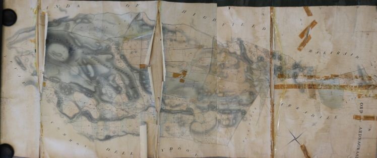
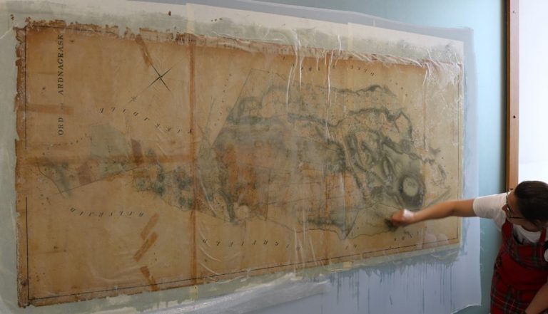
The plan arrived at the conservation studio in pretty poor condition. It had been folded and stored for a long time. The fold lines had worn and split, the right hand portion of the map was detached from the left section, and both sides of the map were covered in loose dust and ingrained dirt.
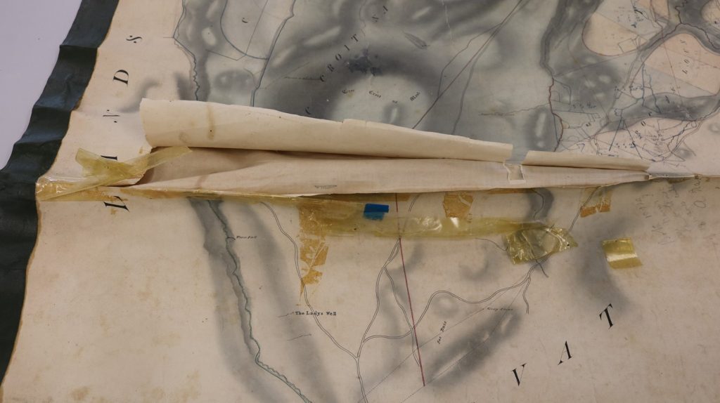
Buckling caused by black cloth tape and splits along the folds
The map before any conservation work was carried out
Staining caused by old sticky tape used to repair tears
Previous attempts to prevent further damage to the edges of the map by applying black self adhesive cloth tape were now causing the map to buckle instead of lying flat. Sticky tape had also been used to repair small tears in map. Over time the adhesive in the sticky tape had dried out leaving the map covered in horrible brown stains.
The map needed a significant amount of cleaning and repair work done to it to preserve it for future generations.
Treatment
Having fully assessed the map, HLH’s Conservation Service drew up a treatment plan for it.
Using a dry cleaning technique the dust was cleaned off the map with an aerated latex (smoke) sponge and a soft goat’s hair brush .
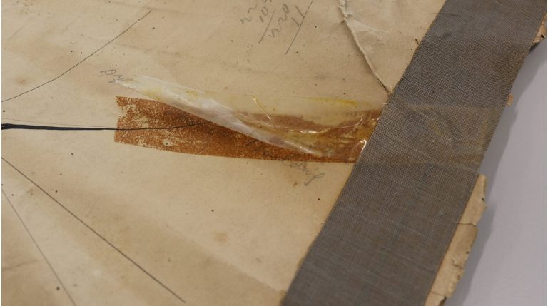
Most of the sticky tape had broken down and dried out. After gently lifting any remaining clear film, the marks that were left were removed using cotton wool swabs dipped in acetone to clean off as much of the old glue as possible.
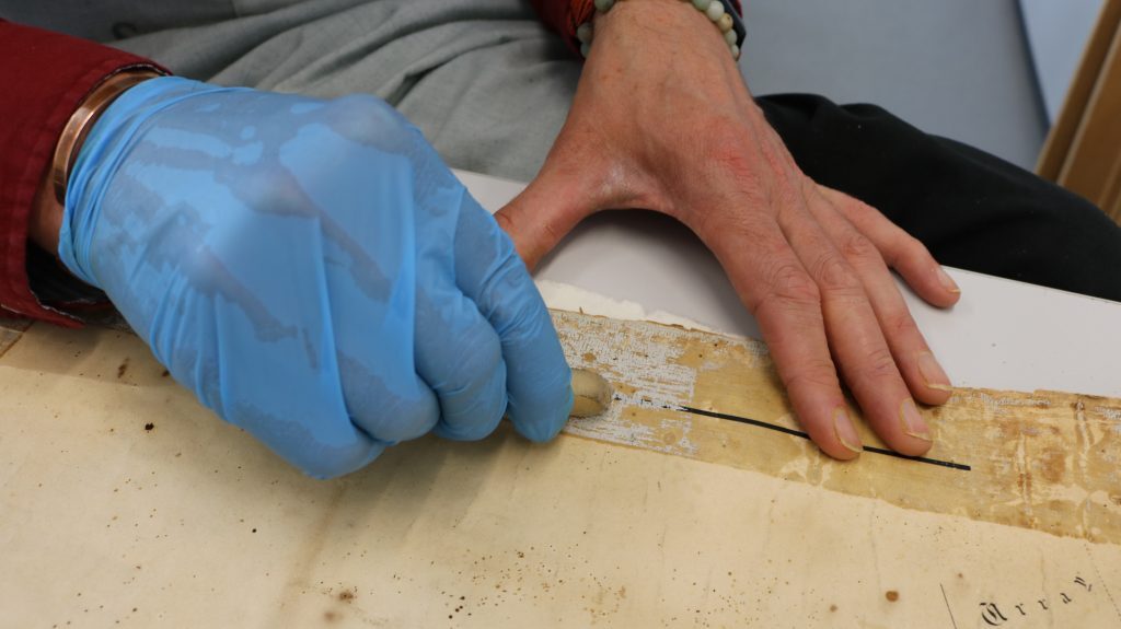
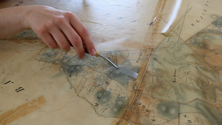
The black cloth tape that was causing the map to buckle was removed by gently warming the tape to soften the adhesive before very gently peeling it off. This process sometimes leaves small patches of adhesive on the paper, so a crepe eraser, a sharp, curved scalpel, and amyl acetate were used to remove as much of the remaining adhesive as possible.
Hidden underneath the black cloth tape was some of the original green silk edging. This had to be removed, but it has been kept and stored alongside the newly conserved map.
The map went through a process of wet cleaning to remove as much of the ingrained dirt as possible. A solution of calcium bicarbonate was sprayed on the map before it was sandwiched between polythene sheeting. Lightly sponging and bonefolding the sandwiched map pushed out the excess solution and with it the dirt and migrant acids in the paper. This process was repeated until the water removed ran clear.
Removing glue left by the black cloth tape with a crepe eraser
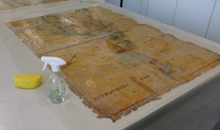
Wet cleaning in progress
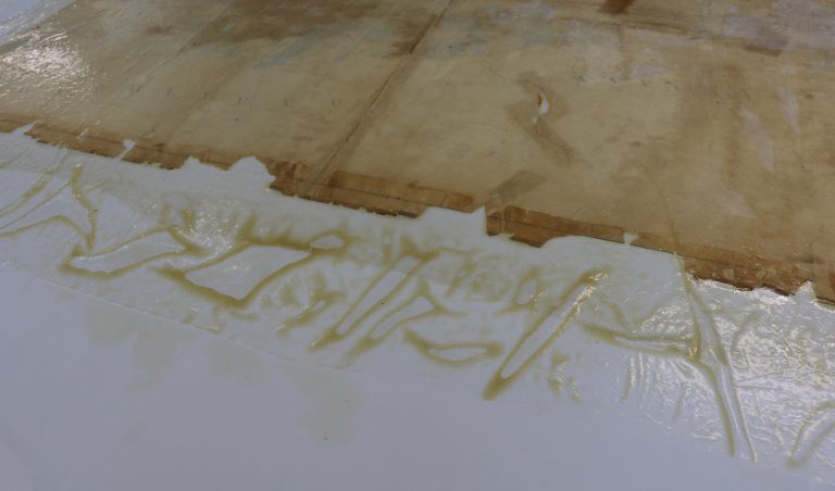
Dirt removed during cleaning
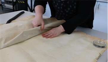
Over time the original lining paper on the back of the map had started to peel off, a process called delamination. The best remedy for this is to remove it and replace the original lining with a new one.
A new lining was prepared using Okawara 60gsm Japanese paper (ideal for paper conservation as it is strong, flexible and light weight) and a special in-house paste mix. The new lining was pasted to a map wall (a special board) in the conservation studio and left to dry for a few days. Meanwhile, the original lining was gently teased off the back of the map. An annotated section of the original lining was kept and later sewn on to the newly lined map so no original information from the map was lost in the conservation process.
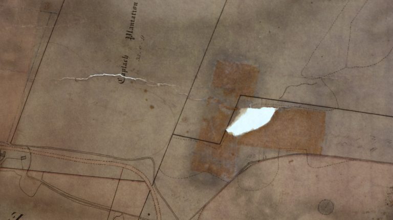
Holes in the map were in-filled using Hosokawa Japanese paper (40gsm). The shape of each hole was traced using a waterpen while the map was mounted on an illuminated light wall, and the paper cut to shape before being fixed to the map using the special in-house paste mix. Other cracks and damaged areas of the map were supported using 5gsm Tengucho Japanese repair tissue fixed in place with the with the paste.
The map was sized. Sizing is a conservation treatment which uses a warm 1.5% gelatine solution that is brushed on to paper using a soft goats hair brush. It replenishes the original paper and prevents future damage from things like mould.
Once dry the map was removed from the map wall and excess lining paper was trimmed.
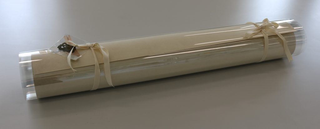
The map, along with the section of annotated original lining and original green silk edging tape, was packaged in a supported, made to measure archival polyester roll which will help keep it clean and safe in the future.
The End Result!
After a lot of time and skill from HLH’s Conservation Team the map was digitised and can now be viewed online here.